Chicago | Reuters — U.S. live cattle futures closed higher on Friday, with the front contract gaining against back months, led by higher cash cattle prices, traders said. Cash cattle […] Read more
Tag Archives COVID-19

U.S. livestock: Firm cash market lifts live cattle
Weaker pork prices, supply ideas drag on hogs

Trust and telehealth services keep veterinarians rolling
Normal biosecurity focus moves to include human health
Technology and long-established client relationships have allowed farm animal veterinarians to maintain somewhat regular operations, albeit with some notable changes, during the ongoing pandemic. Widely used telehealth services, in particular, […] Read more

Hog farmers give back to processing workers
Sofina Foods workers had their lunch paid for by hog farmers
Hog farmers and their local and provincial associations recently donated lunch to pork processing plant workers. The event was part of the Pork Industry Gratitude Project, started in Perth County. […] Read more

Packaged-food majors see sales spike in pandemic
Big brands may benefit from larger, more secure supply chains
Reuters — General Mills on Monday said it saw record demand for its pantry staples, becoming the latest packaged food maker to see business spike during the COVID-19 pandemic, as […] Read more

More Mexican beef headed to U.S. dinner tables as supply crunch bites
"I think we're going to leap past Canada this year"
Mexico City/Chicago | Reuters — More Mexican steaks and other beef cuts are headed north of the border after the coronavirus outbreak has hobbled U.S. meat processing plants, potentially offsetting […] Read more

Australia requests China trade talks over beef, barley
Sydney | Reuters — Australia’s trade minister is seeking urgent talks with his Chinese counterpart after key agriculture exports were hit with suspensions and tariff threats, but said Australia will […] Read more

U.S. livestock: June live cattle limit up on soaring beef prices
Large supplies of hogs, cattle still loom over futures
Chicago | Reuters — U.S. live cattle futures closed higher on Tuesday, with nearby contracts rising the daily maximum, as surging wholesale beef prices and expectations U.S. beef and pork […] Read more

Laid-off foreign workers may get conditional clearance for other jobs
Workers allowed to start new jobs while permits are processed
Approved temporary foreign workers (TFWs) whose jobs disappeared before they could begin work in Canada this spring can now get much quicker approval to start at other workplaces, including farms, […] Read more

Pulse weekly outlook: Lentils stabilize with seeding underway
MarketsFarm — Lentil bids in Western Canada may have come off their recent highs, but prices are still solid and should encourage more seeded area this spring. Increased demand tied […] Read more

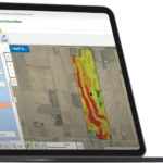
OMAFRA launches new AgMaps tool
The map helps farmers understand the water erosion potential of their fields
A new program involving Ontario’s Agricultural Information Atlas, commonly known as AgMaps, helps farmers determine the soil erosion potential of their fields. The water erosion potential map has been in […] Read more
