Glacier FarmMedia – An imaging system for drones that offers 10 spectral bands has recently been released by MicaSense, a Seattle-based developer of multispectral imaging hardware.
The use of additional different red edge bands can enable users to hone in on different plant canopies to get a better idea of what’s going on in that crop.
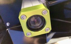
The company sells a five spectral band camera with five separate lenses called RedEdge-MX, as well as its higher-resolution Altum multispectral camera that captures five bands but also captures a radiometric thermal layer.
Read Also
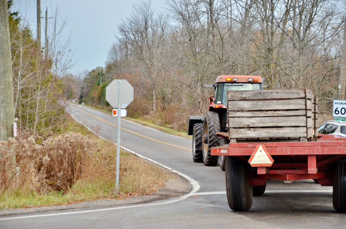
Spring surge in farm traffic sparks renewed safety warnings
Ontario Provincial Police and road safety experts urge caution as farm traffic increases, highlighting equipment rules and on-farm safety concerns.
At the end of 2019, MicaSense took its RedEdge-MX camera and chose five additional optical filters and changed the camera case to blue to differentiate it from the original camera.
“We added those five filters to this camera and called it the RedEdge-MX Blue, and we paired these two cameras together so their capture is synchronized and suddenly we have a 10-band system. So we are capturing 10 spectral bands instead of five,” Drew Baustian from MicaSense said during a webinar.
The RedEdge-MX Blue offers a new blue band, a new green band, and three new bands in the red to red-edge region of the light spectrum.
“We chose the ones that were the most frequently requested, and also took into account which spectral bands are going to best complement the current bands of the RedEdge-MX,” Baustian said.
The original RedEdge-MX camera captures a blue band at a wavelength of 475 nanometers in the light spectrum, green at 560, red at 668, red edge 717 and near infrared at 842.
RedEdge-MX Blue also captures a blue band at 444, which corresponds to be the first band of the 10-band, dual-camera system.
“This band was requested quite a bit. It’s good for classifying aquatic plants; it’s good at indicating what’s mixed into water. So people who were doing flights over water were wanting this to better understand the content of the water,” Baustian said.
Band three in the dual camera system, which is band two for the RedEdge-MX Blue camera, is the 531 band that is relevant for physiology studies.
“There is an index called PRI, it’s the photochemical reflectance index. It’s kind of a boutique index that is used to better understand the physiology of a plant,” Baustian said.
Band five in the dual camera system is 650.
“The benefit of band five is the chlorophyll absorption isn’t quite as strong as it is in 668,” Baustian said.
He said a crop absorbs a lot of red light when it reaches the peak of its growth stage and the canopy’s red light absorption can bottom out, which makes it difficult to see variability across the plant canopy.
“If you run into that scenario where you’re bottom out in red, you can shift over a bit and look at the 650 red band and we can still see variability across the canopy,” Baustian said.
Band seven is 705, which is just beyond the red spectrum and into the red edge.
“It’s good at identifying chloris, leafroll, leaf blotch. There are studies that show it’s good at identifying micro and macro nutrient deficiencies,” Baustian said.
“It’s also good at examining planophilel canopies. Planophile canopies are plants that are parallel to the sky, so they kind of open up and show their leaves to the sky. Erectophile plants are more grassy and they are more perpendicular to the sky.”
Band nine in the dual camera system is 740, which is another red edge spectral band.
The 10 bands in the dual camera system enable direct comparison between satellite and drone data because the bands are similar to the spectral bands of both Sentinel and Landsat satellite systems.
“A lot of people have asked us for spectral bands that correlate with these satellite data sets so they can correlate drone-based and satellite-based spectral data. Anyone who wants to do satellite versus drone-based multispectral comparisons, the 10 band can be useful for that,” Baustian said.
He said the biggest difference with Sentinel 2 data or Landsat 8 data and information obtained via drone with the MicaSense dual camera system is that the MicaSense system provides a resolution of about eight centimetres per pixel with a fixed wind drone while the satellite images are more than a metre per pixel.
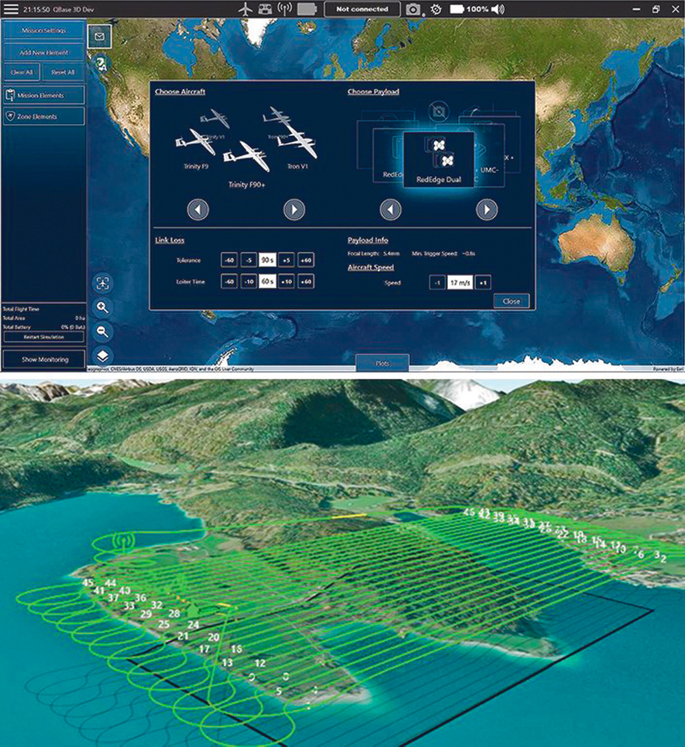
“Every time the Trinity (drone) triggers the dual camera system, it captures 10 images files, 10 TIFF files, and I think the size is 2.5 megabytes each. So it is a lot of data you’re capturing,” Baustian said.
He said the biggest advantage of using the 10-band system is there are many more possibilities of finding an index that is more effective at helping analyze a data set.
“With more spectral bands you have more possibilities for identifying spectral responses of a specific disease, a higher chance of success for researchers or analytics companies wanting to identify not just weeds versus crops, but specific species of weeds versus crops,” Baustian said.
He said the normalized difference vegetation index (NDVI) is generated with near infrared and red, and that the dual camera system has two reds so if a user can’t see what they are looking for in one band, they can look in the other to see if there is any variability from index to index.
“For NDRE (normalized difference red edge index) you’ve got many different possibilities, you can use the 840 with the 740, you can use the 840 with the 717, you can use the 840 with the 705. We’ve even ran indices using the 740 as the near-infrared band and we’ve been able to pull things out of that data that wasn’t visible using the 840,” Baustian said.
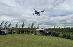
Quantum-Systems out of Germany recently updated its fixed-wing drone and it’s the only fixed-wing drone compatible with the MicaSense dual camera system.
The Trinity F90+ has a flight time up to 90 minutes, post-processed kinematic (PPK) ready with better than two cm accuracy, and a long range telemetry solution of up to 7.5 kilometres.
A company called Measure is the exclusive dealer for Quantum-Systems in Canada.
Teri Ruecker of Measure said the 10-band MicaSense sensors will help users find more indices that will enable them to track down specific crop pests, diseases and weeds and eventually help growers fine tune their crop protection product applications.
“Anytime we can start limiting herbicide and fine tuning what we put on our field is going to be good for both the farmer and the environment,” Ruecker said.
This article was originally published at The Western Producer.