Glacier FarmMedia – Advances in machine learning have enabled agricultural companies to deploy new systems that enhance their services.
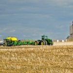
One of the latest companies to hop onto the artificial intelligence bandwagon is Croptimistic Technology that is going to market with its SWAT Cam in a limited release this summer.
Derek Rude of Croptimistic said SWAT Cam’s automated cameras and machine learning models are designed to monitor crops, as opposed to other AI-based systems built to identify and treat weeds in real time.
Read Also
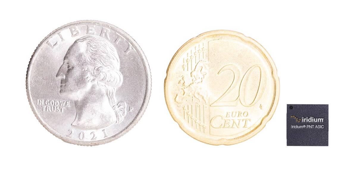
New Iridium technology helps block GPS spoofing
A tiny new chip will allow Iridium’s Positioning, Navigation and Timing (PNT) signals to be received much smaller devices, create a backstop against Global Positioning Systems (GPS) spoofing.
Why it matters: Machine learning tools combined with SWAT cams can help growers monitor crop growth and what areas of a field need attention.
“When we employ a variable-rate strategy, let’s say we’re varying the planting rates and the fertilizer rates by SWAT Zone, we want to know how well we are doing, how well we are establishing that crop, and if we are achieving the goals that the agronomists and the customer have set out,” Rude said.
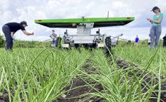
Before deploying the SWAT Cam, Croptimistic must first create SWAT zones with the use of its SWAT Box, an autonomous soil electrical conductivity and elevation mapping system.
The SWAT Cam system will then be used to obtain representative sample images of the field, to help the company scout and ground truth its recommendations.
“We’re trying to find that balance of economics and resolution of the field. So, of course if we were to have cameras across the whole boom the cost to the product would go way up,” Rude said.
“We’re not trying to capture every square inch of a field; We’re trying to get a good representation of it.”

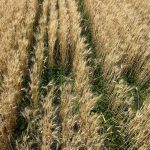
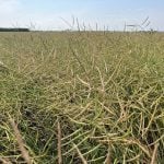
The Swat Cam system focuses on the first two to four weeks of crop establishment.
This was previously done through having Croptimistic staff manually check the zones, which is laborious, time consuming and unable to cover a whole field.
“Whereas SWAT Cam enables us to do that because, of course, sprayers these days are going over these fields many times a year, and they’re covering the whole farm. So, it’s a very economical vehicle to mount sensors on,” Rude said.
“We want to find those areas that you know need further attention and SWAT Cam will be able to enable us to do that.”
He said evaluating the SWAT Zones early in the season is useful for a few reasons, including getting ahead of any potential weather that can damage the entire crop and thwart any agronomic analysis.
The SWAT Cam uses an automated camera on each sprayer boom that is actually a low-cost Samsung phone, which has its own SD card that enables it to automatically upload data through the cellular network.
If service is unreliable, it will wait until the sprayer moves into an area with a better signal before uploading the data to the SWAT record server.
Customers are then automatically notified new records available to view.
“It’s all designed to be automated, that’s with a lot of our products. We want it very easy to integrate, very easy to view the data, and very easy to make sense of that data and turn that into some form of a decision,” Rude said.
The images are captured every 50 to 70 feet, 17 to 20 images per acre, and then the machine learning models quantify crop and weed leaf areas separately once the images are uploaded.
Commercially available satellite imagery currently cannot distinguish between crop and weeds because they only provide vegetative index.
Croptimistic has correlated images from the SWAT Cam to NDVI images from a satellite, and Rude said the SWAT Cam provides a better analysis of crops at an early growth stage.
“The NDVI was more indicative of actually the weeds than the crop because at certain stages, weeds are actually bigger than the crop sometimes,” Rude said.
Once the data is uploaded to the SWAT Cam servers, crop and weed maps are generated. So far, there are 13 different crop models and four weed models available, and in 2023, plant stand counts will be available for some crops.
The system provides a summarization of crop and weed data and an evaluation of variable-rate planting strategies by SWAT zone.
Long-term trends of crop and weed growth by SWAT zones can also be examined.
The image captures are added as a layer to the existing SWAT Maps, so growers can zoom in to take a close look at their crop at various parts of their field.
This can be helpful when farms have multiple sprayers operating in a wide geographical area because farm managers can quickly see crop establishment and what stage weeds are at across the farm.
Croptimistic is working with the electronic engineering department at the University of Regina to test its algorithm’s effectiveness.
“In 2021, we captured over 1.8 million images of different crops, and of course there were lots of weeds in there, too. So, we basically develop a model and then we run those models over all the images we have,” Rude said.
“We’re observing how well it is predicting and if we identify images, for example where the prediction was poor, then we flag that image as a training image and then we return that back to University Regina and then go through the training process again.”
He said training the algorithm is a continual process because there are many variables, for instance a drought stressed plant looks different from a health plant, so algorithms need to be able to take variables like these into account.
Beyond ground truthing the SWAT zones and monitoring early crop establishment, the SWAT Cam may in the future also be used for variable-rate herbicide applications in crops that use a two-pass system.
“Maybe the first pass you would identify where the weeds are and then the second pass you could apply a prescription based on what that first pass was telling you. You can say OK, well there’s not many weeds in these areas so we can hit it with a lighter dose, and we want to hit the hot spots with a higher dose,” Rude said.
He said damage due to insects was also evident on some of the images, so there is a possibility the systems could be used to monitor the damages caused by some bugs.
Croptimistic will be posting updates throughout the growing season on their website and social media channels.
– This article was originally published at The Western Producer.