Ontario continues to convert hay and pasture land to row crop production, with effects on wildlife and habitat.
Why it matters: The federal government’s climate change mitigation strategy encourages the conversion of farmland to hay and pasture but this Ontario study shows a trend in the opposite direction.
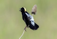
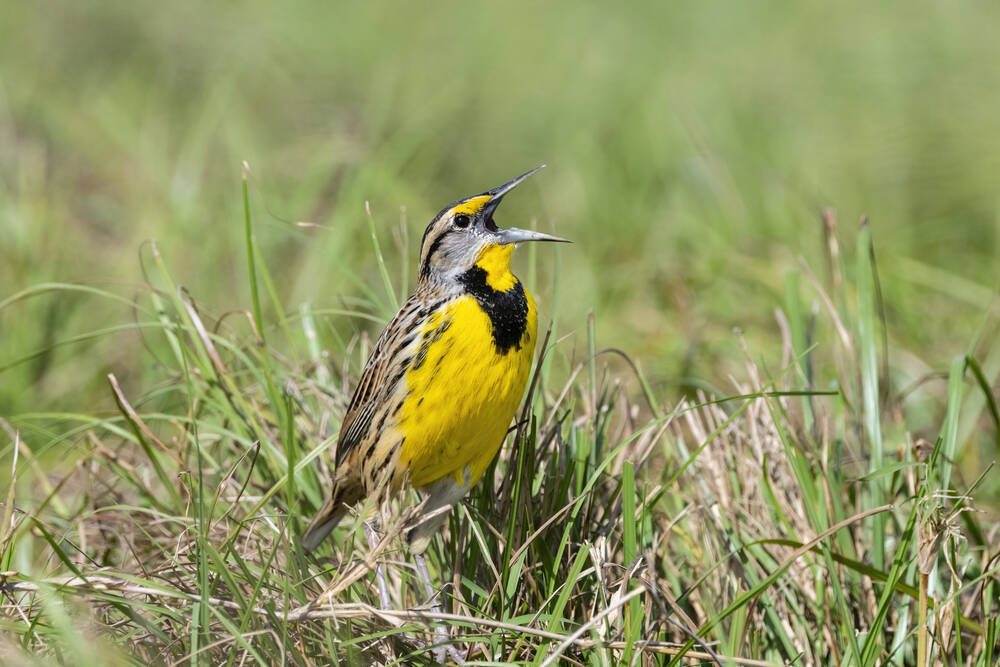
Research conducted by the Canadian Wildlife Federation, aimed at highlighting the “threatened” status of the Eastern Meadowlark on Ontario’s Species at Risk list, draws on Census of Agriculture data and land-cover analysis from Agriculture and Agri-Food Canada, overlaid with avian population estimates from the Ontario Breeding Bird Atlas organization.
Read Also
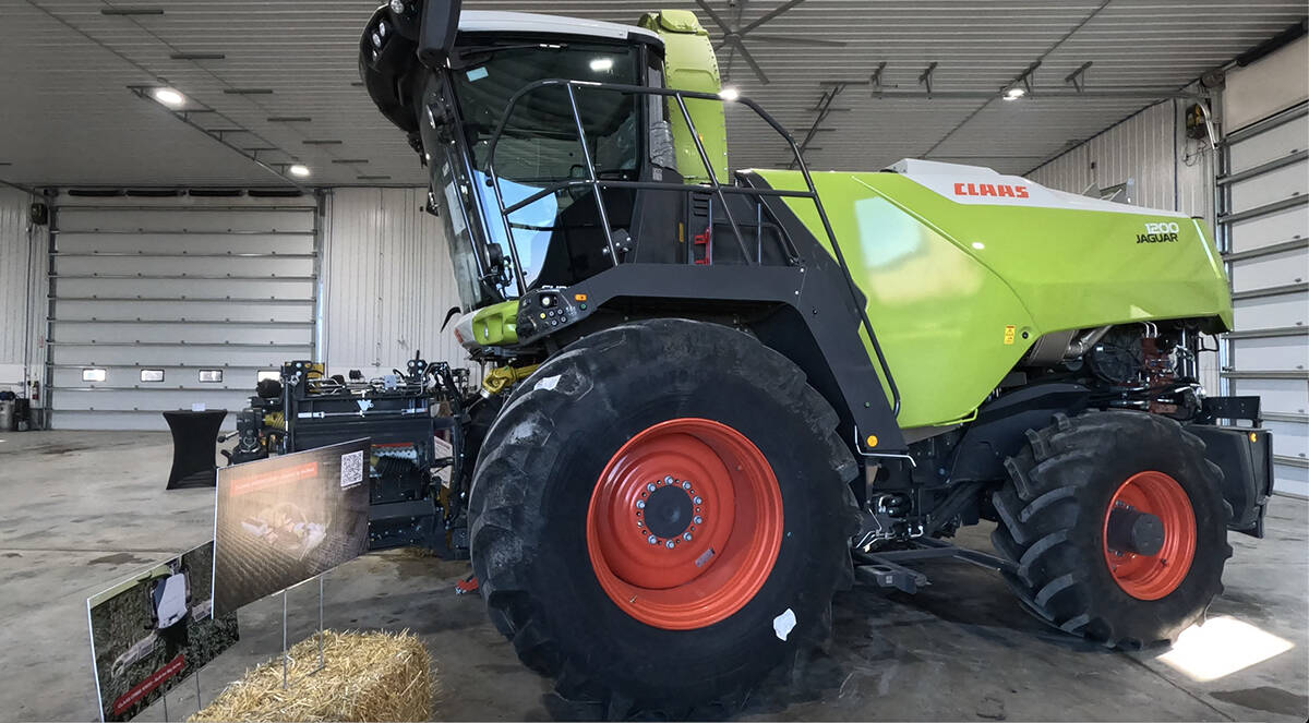
Claas brings 1000 Series SP forage harvesters to Canada
In mid-August, Claas unveiled its new line of Jaguar forage harvesters at an event in Visalia, California, deep in the heart of that state’s dairy region.
“The Census of Agriculture has been reported by producers every five years since 1896,” said Canadian Wildlife Federation staff researcher Vince Fyson, who is part of a three-member team who wrote the report.
“These data show a clear signal in loss of perennial land and increase in annual cropland.”
But in 2009, AAFC “improved the precision of land use data by creating a digital annual crop inventory. This has allowed us to explore land use change at a much finer scale,” added Fyson.
In addition, “remotely sensed data has improved drastically over the past decades (to the degree that) we now have access to frequently updated, high resolution, and reliable land use data for the entirety of southern Ontario and Quebec.”
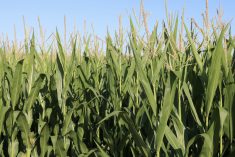
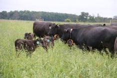
The team’s analysis of 2011-22 data from Canada’s Mixedwood Plains ecozone is conclusive: “The total agricultural land area changed little over the study period, but the area of pasture and forage decreased while row crop area increased,” said the report, published in the science journal Facet.
“Declines in Eastern Meadowlark abundance correlated significantly … suggesting that habitat availability (in the form of pastureland) is a limiting factor for this species.”
Fyson said the ready availability of data about the Eastern Meadowlark led to the decision to use that bird as the species with which to link the land-cover research. On the provincial government’s Species at Risk website, the “threatened” status is defined as “liv(ing) in the wild in Ontario, is not endangered, but is likely to become endangered if steps are not taken to address factors threatening it.”
“The recent State of Canada’s Birds report from Birds Canada indicates that grassland birds are experiencing a steep rate of decline,” Fyson told Farmtario in an email.
“These birds are ground nesters in grasslands, and pasture and hay lands in the Mixedwood Plains Ecozone have provided good nesting habitat… . We were curious to see the extent of the loss of this habitat and found that there has been a loss of more than 25 per cent between 2011 and 2022.”
“The lack of remaining native habitat in the ecozone means Eastern Meadowlarks face regional extirpation if suitable farmland habitat is not conserved or grassland habitat restored,” the Facets article adds.
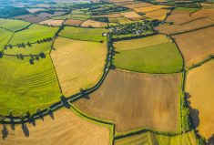
The Mixedwood Plains Ecozone encompasses all of southern Ontario along lakes Huron, Erie and Ontario, and north and south of the St. Lawrence River through southern Quebec. Agriculture represents 55 per cent of the land area. The ecozone contains 34 per cent of Canada’s farms and 14 per cent of Canada’s farmland.
In 2021, there were also approximately 20.1 million people living in the ecozone, an increase of 10.4 per cent compared to 2011. Analysis of the land-cover data to estimate habitat loss due to human settlement didn’t paint as dire a picture in terms of the year-by-year loss of total agricultural land.
Farmland is being lost, the study said, but other types of land cover are also being turned into farmland in the province.
“The loss of agricultural lands to urbanization was partly offset by the conversion of forests and wetlands (to farmland); however, the farmland gained was of lesser agricultural quality than the farmland lost.”
The team’s analysis of the 2011-22 land-cover data is revealing in several ways.
The study found that more than 160,000 acres of agriculture land were converted to urban, primarily in the Greater Toronto Area. A net loss of over 37,000 acres of forest to agriculture was seen, with a hot spot of deforestation for agriculture east of the Rideau River system. Over 13,000 acres of wetlands were converted to agriculture with a hot spot in the County of Dufferin.
But “the total area of agriculture remained virtually unchanged over the study period,” the article notes, and from the list of possible transformations, it’s hay/pasture-to-row crop that stands out most.
A ratio of 8.4 million acres of annual crops to 420,000 acres of pasture/forage in 2011 changed to 9.5 million acres of row crops and 314,000 acres of pasture/forage in 2022.
“The conversion of pasture/forage to annual crops was the largest land cover change that we observed,” the article said. The most significant transformation occurred “along the edge of the Canadian Shield.”
The analysis also revealed average farm field size increased across the ecoregion from 2011-22. Although the study’s authors cited prior research pointing to decreased biodiversity as fields get bigger, field size was not a part of the study.
“We have ideas for research that would help producers to better understand how natural cover can help the climate resiliency of their farms,” Fyson said.
He added the wildlife federation research team “would like to see the province of Ontario and municipalities recognize farmland as important to society,” and calls on “governments at the municipal, provincial and federal level (to) develop policies that consider the impacts of land changes on agricultural production, climate change resiliency and biodiversity.”
Fyson argued the financial burden of putting such policies into action shouldn’t fall on farmers.
“We understand that producers need to make a living and make land use decisions according to market signals and other factors.” Instead, “we view that the retention of natural habitats on farms is a public good, and producers should be rewarded for this.”