
The latest technology to provide enhanced imaging and monitoring of field conditions was previewed April 3 with a webinar launch among dozens of agronomists, certified crop advisors, growers and other interested viewers.
Hosted by Deb Campbell of Agronomy Advantage, the presentation unveiled the SWAT Cam system and outlined its use and access to a software platform that assesses a crop based on its weed leaf area.
Why it matters: SWAT Cam can offer an in-depth analysis of weed competition and crop growth.
Read Also
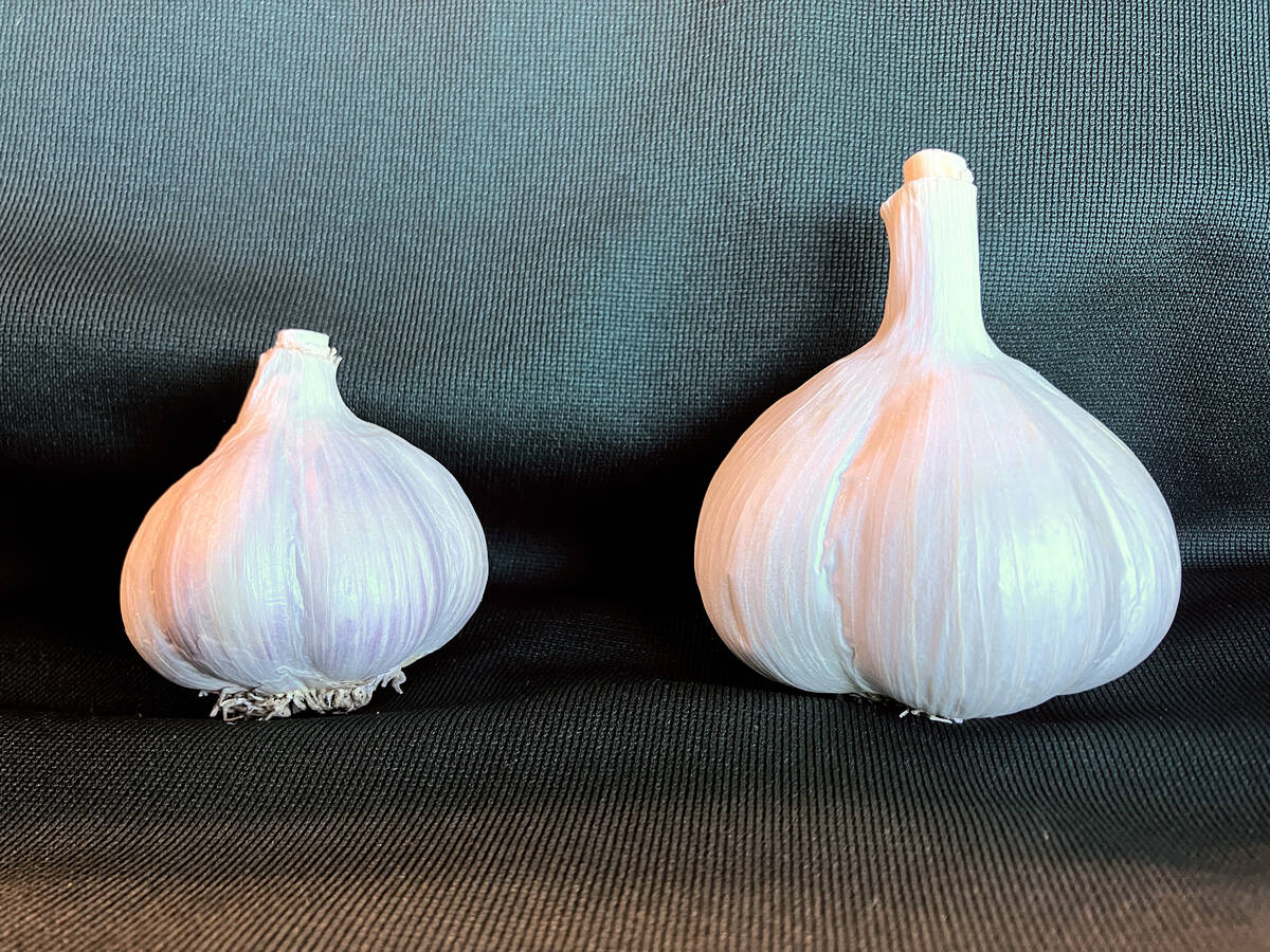
Clean seed garlic promises bigger bulbs and higher returns for growers
Ontario garlic trials show clean seed outshines conventional yields, with stronger drought resilience, reduced virus risk and greater economic outcomes.
Cory Willness and Derek Rude of Croptimistic Technology in Naicam, Sask., said SWAT Cam can provide in-depth analysis of crop progress and weed competition through a suite of software units under the SWAT Ecosystem technology.
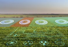
The centrepiece is the SWAT Cam, an imaging unit mounted to a sprayer, with one on each boom. The unit can capture images every 50 to 70 feet, which are uploaded to the SWAT Records component. From there, the software assesses the crop’s performance, complete with a crop and weed map summary of a field or zone.
It’s billed as the best technology available for variable-rate applications. Crop and weed data are generated separately, unlike satellite imagery. As Rude pointed out, the problem with current in-field analysis and plant counts is they’re labour-intensive, monotonous, low resolution, costly for the amount of data retrieved and can be subjective in terms of where they’re done in a field.
“They’re not finding the problem areas, so it’s not the best approach because it doesn’t get into all corners of a field,” said Rude, adding that satellite imagery can also be sporadic due to cloud cover.
The image he provided in his presentation showed a vast array of black dots across a field map, where every dot represented 2,000 images captured. Every image is run through the software, producing a crop map that assesses the overall performance on a zone basis.
As-applied data can be incorporated with seed and fertilizer applications. Once the images are run through the SWAT system, it generates a quantified crop analysis with respect to weeds. It predicts crop progress largely based on biomass.
“The key to SWAT Cam is the data they can retrieve and then tie back to these zones,” said Rude.
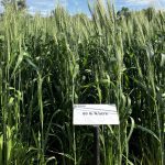
Several attendees questioned the western Canadian focus of the technology. Although the current crop models listed for the SWAT Cam include wheat, barley, oats, durum, corn, soybeans, flax, canola, lentils, peas and potatoes, the focus on in-field trials was obviously weighted to cereals. And the primary weed species integrated into the SWAT Cam trials was kochia, with resistant biotypes that pose a considerable challenge to Prairie growers.
There were questions about the adaptability of the SWAT Cam system to identify and locate waterhemp. That weed, along with Canada fleabane, is a growing challenge for eastern Canadian growers. Both species have biotypes that are resistant to multiple modes of action, so identifying them as part of a zone or field map is integral for adoption in the East.
Rude said the focus has been on kochia in the West but the primary utility for SWAT Cam is to generate maps that relate to crop health and performance. If there’s a case for developing a model for a particular problem weed in the future, they’d consider it.
Campbell asked whether wheat, which appears to be based on percentage of ground cover, could be the “next step” for population counts. Rude said corn, soybeans and canola are all undergoing “beta” counts for actual populations. But work is ongoing at various research sites, including Canada’s Outdoor Farm Show, to improve the models.
SWAT Cam technology costs $3,950, with access costing 50 cents per acre for all SWAT-mapped acres.
“The real value is when you tie it back to those maps and you don’t pay it over and over,” said Rude. “The prescriptions are easy to do, so the costs per acre are low.”
– Read more from Ralph Pearce in Country Guide.