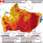
La Niña conditions are present and there is a 59 per cent chance of it persisting through February-April 2025, with a 60 per cent chance of transition to ENSO-neutral conditions during March-May 2025, a U.S. government forecaster said on Thursday.
weather — page 5

US forecaster says La Niña conditions present, could persist through Feb-April

Prairie forecast: Battle between warm and cold
Forecast issued January 8, covering January 8 to 15, 2025
For this forecast period, the weather models have been bouncing back and forth between a return to cold weather after a brief mid-week warmup or a return to the mild weather pattern we saw during much of December. The models have been slowly converging towards the milder solutions, but at this point confidence in the second half of this forecast period is low.

Canadian Prairies, U.S. Midwest to get colder in January as South America becomes hotter, drier
Some warmer temps for Prairies during week of Jan. 6
Meteorologist Drew Lerner said he expects colder than normal temperatures across the Canadian Prairies and much of the United States Midwest in January, while a good portion of South America is to be hotter than normal.

What are atmospheric rivers and why do they cause flooding?
Atmospheric rivers are storms akin to rivers in the sky that dump massive amounts of rain and can cause flooding, trigger mudslides and result in loss of life and enormous property damage.

Prairie forecast: Colder weather moving in with the New Year
Forecast issued Dec. 31, covering Dec. 31 to January 8, 2025
For this forecast period, it looks like the quiet weather pattern will continue as the weather models are not showing any big storm systems impacting the Prairies. We should continue our slow cooldown with temperatures during most of this forecast period looking to be near to below average.

Prairie forecast: Mild, quiet holidays expected
Forecast issued Dec. 24, covering Dec. 24 to Dec. 31, 2024
The weather for this forecast period will be largely controlled by a large, stationary area of low pressure in the Gulf of Alaska. This has been sending wave after wave over energy into coastal B.C. This will result in a predominately west to southwesterly flow across the Prairies—meaning a continuation of mild temperatures as Pacific air dominates.

Prairie forecast: Cold start, but then turning mild
Forecast issued Dec. 18, covering Dec. 18 to 25, 2024
To start this forecast period, we have a strong area of Arctic high pressure dropping southeastwards behind the area of low pressure that hit the eastern Prairies earlier in the week. This high will bring a quick shot of cold weather to Saskatchewan and Manitoba from Wednesday to Friday.

More than 50 per cent chance of La Niña in coming months, WMO says
There is more than a 50 per cent chance of La Niña developing in the next three months, the World Meteorological Organization (WMO) said on Wednesday, but if it does it will be relatively weak and short-lived.

Prairie forecast: Cold start for the east, overall warm, dry expected
Forecast issued Dec. 11, 2024, covering Dec. 11 – Dec. 18, 2024
To start this forecast period, the strong area of low pressure that tracked through the eastern Prairies is now over Hudson Bay. The rotation around this low is opening the door for a strong, very cold Arctic high to build southwards into the eastern Prairies. This looks to bring some of the coldest temperatures so far this winter to eastern Saskatchewan and western Manitoba. The good news is that it doesn't look like the cold air will stick around long.

More precipitation at the start of winter says Environment and Climate Change Canada
Environment and Climate Change Canada (ECCC) presented its winter seasonal outlook on Dec. 4. Officials said they expect temperatures across the country to be close to or above normal for the beginning of winter. However, they pointed out Western Canada is likely to experience normal to below normal temperatures come January and February.