The Saskatchewan government says it will put up to $70 million toward “immediate measures” to support livestock producers, ahead of an expected federal-provincial AgriRecovery program for that purpose. Application forms […] Read more
Tag Archives weatherfarm news

Saskatchewan front-loads AgriRecovery funding
Joint federal-provincial program development still underway

Prairie Forecast Update: Southern areas may get Hilary’s leftovers
Issued Aug. 20, covering Aug. 20-23
An interesting weather pattern is currently in place across western North America with Tropical Storm Hilary taking an unusual northerly track as it comes in off the Pacific Ocean south […] Read more

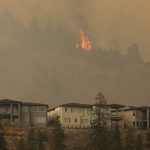
B.C. wildfires intensify, evacuation orders double
Rain helping slow fires near Yellowknife
Kelowna | Reuters — Forest fires in British Columbia intensified on Saturday, with the number of people under evacuation orders doubling from a day earlier, as authorities warned of difficult […] Read more

Prairie Forecast: Upper ridge to bring the heat
Issued Aug. 16, covering Aug. 16-23
After going through a couple of weeks of tough forecasting, with little agreement among the weather models, this forecast period is looking a little more stable with the two main […] Read more

Soil microbes help plants cope with drought
Science Notes: Microbes seen to adapt to drought over time
Plants call out with chemical signals in times of stress, summoning microbes that can unlock bound nutrients and find water in soil pores too small for the finest roots. In […] Read more

Prairie Forecast Update: Low to chug through mid-week
Issued Aug. 13, covering Aug. 13-16
The weather models seem to have come to an agreement on the area of low pressure forecasted to come in off the Pacific around mid-week. It looks like the energy […] Read more

Canada’s record-setting wildfires could persist for rest of ‘marathon’ summer
Country's fires account for over a quarter of world's carbon for 2023
Ottawa | Reuters — Record-setting wildfires in Canada could potentially continue burning at an abnormally high rate for several more weeks, though the spread of blazes is likely to start […] Read more

Weather conditions leave soybeans with wet feet
Damp areas may look worse than they are and there’s little response from adding more nutrients
The effects of a wet July are appearing in soybean fields across parts of southern Ontario, and although plants appear to be yellowing, it’s too early to assess the impact. […] Read more

Prairie Forecast: Cooler and unsettled
Issued Aug. 9, covering Aug. 9 to 16
First off, I must apologize for not producing an update to the last forecast; I had the opportunity to do some backwoods camping, which meant I was off the grid […] Read more

Prairie forecast: Warm-hot start then slow cooldown
Issued August 2, covering August 2 to 9
The weather models have been doing a good job with the overall weather picture over the last several weeks, despite a fairly unsettled, tough-to-figure-out weather pattern. In this next forecast […] Read more
