Forecast issued November 12, covering Nov. 12 to 19, 2025 Highlights Once again, the weather models had a good handle on the overall weather pattern. Small variations in the timing […] Read more
Tag Archives forecast

Prairie forecast: No real signs of winter yet
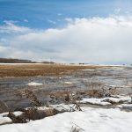
Prairie forecast: Quiet pattern continues as winter struggles for a foothold
For the upcoming forecast period, a large area of low pressure remains anchored off the British Columbia coast, a strong low spins over the Atlantic coast and another, weaker low lingers near Hudson Bay. Between these systems, the flow across the Prairies is largely zonal, meaning it moves west to east with little north–south movement. That pattern will help usher a few weak disturbances across the region during the next several days.

Prairie forecast: A slow cool down towards winter
Forecast issued October 29, covering Oct. 29 to Nov. 5, 2025 Highlights: Overview I can’t say last week’s forecast played out exactly as expected — but that’s not too surprising. […] Read more

Prairie forecast: Warm start, then cooler
Prairie forecast calls for warm temperatures to give way to cooler, wetter weather week of Oct. 22-29.
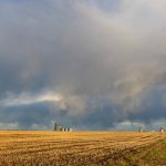
Prairie forecast: Active pattern continues with mostly-dry west, wet start for east
The active pattern that we saw last week looks to continue into this forecast period which means more chances for rain, possibly some wet snow and a continuation of the temperature rollercoaster ride.
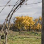
Prairie forecast: A temperature rollercoaster and the possibility of snow
Prairie forecast covering October 8 to 15, 2025. The Prairies may be in for a prolonged battle between warm and cold air before winter sets in. This could bring lots of rain or snow.

Prairie forecast: Transition from warm to cool brings chances for rain
The big question leading into this forecast period is — just how long will the summery temperatures will continue? After all we are now into October.

Prairie forecast: Looks like summer weather
Highlights: We appear to be in a fairly predictable weather pattern as the overall weather picture has been pretty good. We saw upper-level ridging last week bring average to above […] Read more

Prairie forecast: Warm, dry west; warm, unsettled east
Highlights Summary Last week’s forecast did well considering the unusually blocking pattern that developed. An area of low pressure did develop as expected over the west-central U.S. It tried to […] Read more

Prairie forecast: Summer holds on
Once again, the weather models did a good job with the last forecast. It correctly predicted the cool weather pattern over the eastern Prairies, which did bring some light scattered […] Read more

