

MarketsFarm — December marks the start of what meteorologists call “meteorological winter” — and this winter, the Pacific Ocean phenomenon known as La Nina may be rearing its head once again.
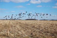
La Nina (Spanish for “little girl”) is a climate pattern detected over the Pacific every few years where cooler water pools at the equator and can cause exceptional weather events during the North American winter, such as greater precipitation on British Columbia’s coast and colder temperatures in the eastern Prairies.
Last winter, La Nina was detected and while there were milder-than-normal temperatures early on in the eastern Prairies, they gave way to frigid temperatures in late February, resulting in a dry winter. The U.S.-based National Oceanic and Atmospheric Administration (NOAA) is currently predicting a 90 per cent chance of a “double-dip” this winter.
Read Also

El Niño risk building, U.S. forecaster says; ENSO-neutral expected to continue to June
U.S. forecasters say there is an 80 per cent chance of more stable ENSO-neutral weather conditions from April to June as La Niña transitions toward El Niño.
Scott Kehler, co-founder, president and chief scientist of Winnipeg-based meteorological firm Weatherlogics, is not ready to confirm another instance of La Nina this winter, but there are indications of a repeat.
“It appears very likely La Nina will develop. We’re seeing signs that the water in the central Pacific will be colder,” he said. “It’s really just a question on whether it meets the official criteria of La Nina, which requires it persists for a number of months. Regardless, it will be close to or in La Nina territory for the winter.”
Kehler added that there have been some hints of weather conditions consistent with La Nina, but its full effects won’t be seen until later in winter.
“Usually for the Prairies, what La Nina means is colder-than-normal weather, especially in the eastern part of the Prairies,” he added. “Actually, the western part ends up a bit warmer than normal. If you do typically get colder-than-normal temperatures, that tends to be associated with more snow than normal, as well.
“Thus far this fall, we’re not seeing too much of that impact, as weather has been still normal or a bit warmer than normal across the Prairies.”
While mild temperatures have persisted throughout November in the eastern Prairies, it is too early to know whether or not this year’s La Nina pattern will shape up like last year’s, according to Kehler.
However, his own winter weather predictions for the Prairies feel like a case of deja vu.
“The Prairies will have a warmer-than-normal winter and also it will be drier than normal, on average,” he said. :There may be small areas with a little bit snowier weather, but I think overall we will have a dry winter again. Not too different from last year.”
— Adam Peleshaty reports for MarketsFarm from Stonewall, Man.