With summer often comes weaker pressure patterns, as the difference in temperatures between the north and south decreases. Sometimes this makes for easy forecasting while other times it can make forecasting the weather a pain in the you know what. This is what we saw during the last half of last week’s forecast as the weather pattern changes significantly as small changes compounded during the week, and this week’s forecast is looking like it might follow the same pattern. There does not look be any strong systems that will be dominating our weather over this forecast period which means changes in any to the systems, especially early in the forecast, can have compounding effects later in the week.
Read Also

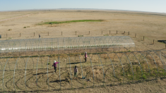
Prairie forecast: Warm start, then cooler
Prairie forecast calls for warm temperatures to give way to cooler, wetter weather week of Oct. 22-29.
Overview
We start this forecast period off with an area of low pressure over far northern Manitoba that is slowly moving off into Hudson Bay. To the west, an area of low pressure is developing over the Yukon which is helping to develop a weak ridge of high pressure over Alberta. Over southern Saskatchewan and Manitoba weak high pressure is in place.
The weather models are showing the Yukon on a low slowly drifting east wards. This low looks to bring some unsettled weather to the northern half of Alberta on Thursday and Friday before it begins to drop southeastwards bringing unsettled weather to Saskatchewan and Manitoba over the weekend. At this time, it does not look like this system will bring large amounts of precipitation but there is the potential for around 15 mm of rain over eastern Manitoba which desperately needs it to help fight the forecast fires.
This low looks to spin off to the east of the prairies by Monday allowing for a building ridge of high pressure over the western Prairies to move eastwards. This ridge looks to bring sunny skies and warm temperatures right across the prairies to end this forecast period. As usual, with sunny skies and warm temperatures, there is always a chance of afternoon thunderstorms!
Alberta
This forecast period will start off with a mix of sun and clouds along with the chance of the odd shower or thundershower as weak instability moves across the province thanks to an area of low pressure moving through the Yukon. Temperatures look to be seasonable with daytime highs in the 20 to 23 C range with overnight lows falling to around 10 C.
Saskatchewan and Manitoba
We start this forecast period off with an area of low pressure slowly sliding off into Hudson Bay. The counterclockwise flow around this low will push some slightly cooler air into both regions with daytime high right around the 20 C mark. With the cooler air and strong sunshine, we can expect some afternoon cloudiness along with the odd shower or thundershower. Areas experiencing widespread smoke will see slightly cooler temperatures and also a suppression of the afternoon clouds and showers.
Over the weekend an area of low pressure is forecasted to drop southeastwards out of northwestern Canada and is expected to be situated over southern Manitoba by Sunday morning. Confidence in the timing and track of this low is not that high, but should it materialize as forecasted, expect partly to mostly cloudy skies along with widespread showers across Saskatchewan on Friday and over southern and central Manitoba on Saturday and Sunday.
This low will move off to the east by Monday allowing for the western ridge of high pressure to build across these regions. This ridge will bring plenty of sunshine to start the week along with warm temperatures. Expect daytime highs to be in the mid to upper twenties, with lows in the 12 to 15 C range.