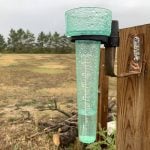
It is definitely looking like summer is moving in, but that doesn’t mean we are totally out of the woods for cool days. The weather models did a fairly good job with the overall big picture over the last week, but it missed few things, and I did too!
The biggest miss was the instability that worked into Alberta late in the forecast period. This brought showers and thunderstorms.
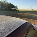
While it was predicted that the eastern Prairies were going to be under the influence of a large Arctic high over Ontario, I should have realized how dry the high was going to be. That dry air allowed for good daytime warming, but it allowed for cool to even cold overnight lows with sporadic frost hitting part of southern Manitoba. For this forecast period, it seems like a fairly simple and straightforward forecasts. But as I have pointed out many times, the devil is in the details.
Read Also
Trump plan to import Argentine beef angers U.S. farmers
U.S. farmers criticized President Donald Trump’s suggestion that the country may import more beef from Argentina, after they recently lost out to the South American nation on soybean sales to top buyer China.
We start off with high pressure dominating most of the Prairies. A large surface high is sitting over the north-central U.S. This is beginning to tap into more heat and moisture, which will allow for warmer daytime highs and nighttime lows as dewpoints creep up.
As we approach the weekend, the surface high will begin to break down while a large area of low-pressure tracks across the high Arctic. This will build an upper-level ridge across the Prairies, which will bring daytime highs of around 30 C to a swath of the region.
As the upper-level ridge progresses eastwards, two areas of low pressure are forecasted to form on the back side of the ridge. The first low will develop over central Alberta and work northeastwards on Monday and Tuesday. A second area of low pressure is then forecasted to develop over the western U.S. and track northeastwards towards southern Saskatchewan and Manitoba on Tuesday and Wednesday.
Alberta
This forecast period will start with plenty of sunshine and warm temperatures as weak surface high pressure combines with a building upper ridge. Expect daytime highs in the upper twenties to around thirty degrees and overnight lows in the 12 to 15 C range.
Thursday night and into Friday morning, an area of low-pressure tracking eastwards through the Arctic will drag a cold front through the province. This will bring a good chance of thunderstorms. The best chances are expected to be over central and northern regions. Behind the front, expect temperatures to cool down with daytime high on Friday and Saturday forecasted to be in the low twenties.
Late on Saturday and into Sunday, the weather models show another area of low pressure spinning up over central Alberta and tracking northeastwards on Monday. This low will bring the chance of showers mostly to west-central and northwestern regions with potential for significant accumulations.
Cooler air looks to wrap in behind the low, which will bring some unseasonably cold air to far northern regions on Tuesday and Wednesday. Further south it looks to be dry and warm but an area of low pressure to the south could bring some showers to far southern regions on Tuesday.
Saskatchewan and Manitoba
It’s a short and sweet forecast for this region. Well, maybe sweet is the wrong term. If you like sunny skies, warm to hot temperatures and no rainfall, then it is a sweet forecast. For those regions dealing with dry conditions and forest fires, then it is not the best forecast.
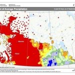
Personally, I have a pond on my property and for the first time in 20-plus years I had to run water into it in May. Usually I don’t have to do that until late June! Meanwhile, other areas have been too wet.
A building upper ridge will bring plenty of sunshine and warm to hot weather across both provinces over the next five or six days. Expect daytime highs to slowly work into the upper twenties and low thirties with overnight lows dropping into the low teens across Saskatchewan and mid teens in Manitoba.
Early next week an area of low pressure is forecasted to develop over the west-central U.S. This low should push northeastwards on Tuesday and Wednesday. This will bring widespread showers, thunderstorms, and rain to southeastern Saskatchewan, southwestern Manitoba and then central Manitoba as the low lift northeastwards.
Hopefully the low pushes further east to bring some much-needed rain to eastern Manitoba, but current indications are that the Winnipeg region will be the cut-off line for any significant rain. As usual, a lot can change with systems this far out.


