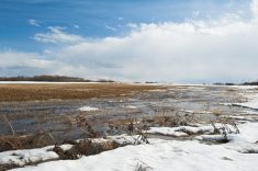
There’s an interesting weather pattern developing across much of southern Canada and the U.S. for this forecast period.
There’s a large area of low pressure situated over the Great Lakes that will slowly track to the east coast by the weekend. A second area of low pressure is developing over northern B.C. while a trough of low-pressure is digging southwards along the Pacific coast. This low is forecasted to track northeastwards and then weaken as a second area of low-pressure forms over the northwestern U.S. That low is then forecasted to wobble around the 4-corners regions of the southwestern U.S. over the next several days before tracking eastwards and weakening over the weekend. Between these two systems is a developing upper ridge.
Read Also
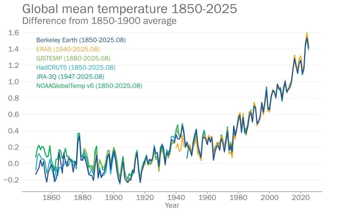
2025 set to be among hottest years on record: WMO
With only two months remaining in the year, 2025 is set to be among the top three hottest years on…
Now how is all of this going to impact the weather across the prairies?
In a nutshell, it looks like Saskatchewan and Manitoba will see dry weather and nice, warm, spring temperatures. Alberta is going to have to deal with colder air being drawn southwards into the developing storm system over the south-central U.S. Along with the colder air, southern Alberta may deal with some more snow as moisture is pulled northward and then westward on the eastern side of the low.
Once we get past the weekend it looks like things will settle down across Alberta and warm early spring weather will spread back into the region.
Alberta
Much of the northern half of Alberta looks to see clouds with showers changing to flurries over the next couple of days as the low over northern B.C. tracks to the east and weakens. It does not look like there will be much in the way of accumulations from this system with only a few millimeters of water equivalent precipitation expected.
Temperatures will be on the cool side as the flow behind the low becomes northerly. Expect daytime highs in the +2 to +4 C range and over night lows falling to around -3 C.
Over the southern half of the province things are a little more complicated. As the low over the northwestern U.S. develops, the supporting trough of low pressure will allow the low to drop southwards and intensify. This low will begin to pump moisture northwards and current indications are that two to three rounds of moisture will move into extreme southern and western parts of the province. The first round looks to be on Thursday, followed by a second on Friday and then possibly a third late Saturday. Confidence on the timing or exactly how far north the moisture will push is low at this point but confidence in the development of the system is high. Temperatures will be cool with daytime highs in the low single digits and overnight lows falling a few degrees below zero.
As the southern low moves east and weakens late in the weekend, mild air will begin to flood back in. This will push daytime high back into the double digits across most of the province, with overnight lows falling into the +2 to +5 C range. These temperatures are expected to last through the week.
Saskatchewan and Manitoba
I am lumping these two provinces together as their forecast for this period will be very similar – dry and mild.
The building ridge of high pressure will bring very mild temperatures to much of southern and central Saskatchewan on Wednesday, Thursday, and Friday. Thursday or Friday will be the warmest day with daytime highs possibly pushing into the low twenties, especially from Regina southwards. This mild air will begin pushing into Manitoba on Wednesday, with daytime high rising towards the 10 C mark. Highs should warm into the 14 to 16 C range by Friday or Saturday.
Skies looks to be mainly sunny and winds look to start off light but are forecasted to becoming quite breezy from the south on Friday and Saturday, especially over eastern Saskatchewan, and western Manitoba.
Temperatures look like they will cool down over both provinces late in the weekend or early next week as the upper ridge collapses. Expect daytime highs to drop back down to around the 10 C mark with overnight lows falling a few degrees below zero. There are indications that the upper ridge will begin rebuilding around mid week with some hint of highs in the low to mid-twenties by late in the week, but as usual that is a long way off and a lot can change between now and then.
— Daniel Bezte is a teacher by profession with a B.A. (Hon.) in geography, specializing in climatology from the University of Winnipeg. He operates a computerized weather station near Birds Hill Park, Man. Contact him via email with your questions and comments.