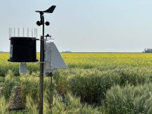


With no big storm system impacting our region, the weather models have been doing a good job with the forecasts over the last few weeks. As we start to move closer and closer towards the middle of winter, the longer we can keep the warm air around, the shorter we can hope winter will be. With that said, here is what the big picture is looking like over the next seven or so days.
We start off with a ridge of high pressure that has edged its way into the southern prairies, bringing mild early December temperatures. This ridge is expected to slide east and slowly collapse back down to the south. As it does, an area of low pressure is forecasted to form over southern Alberta or northern Montana and then track eastwards bring with it a mixed bag of precipitation.
Read Also

Pulse Weekly: SaskPulse optimistic despite input, crop price concerns
SaskPulse executive director Carl Potts is optimistic ahead of the planting season despite lower crop prices and the war in Iran.
Behind this system, the general flow across the prairies is expected to become northwesterly as a large area of low-pressure winds up over eastern Canada and then drifts to the north and then northwest as it moves into the arctic. Embedded in this northwesterly flow will be weak areas of low pressure coming in off the Gulf of Alaska. This low will bring occasional, slight snow to some regions but little in the way of accumulation is expected. It looks like temperatures will cool a little bit but will likely remain near to above average for this time of the year.
Alberta
The northern half of the province will start this forecast period seeing sunny to partly cloudy skies and near average temperatures. Expect daytime highs in the -2 to -8 C range with overnight lows falling into the -10 to -16 C range. The sunny to partly cloudy conditions should last through the weekend. The weather models then show an area of low pressure dropping out of the northwest, bringing with it clouds and some light snow on Monday or Tuesday. Accumulations look to light with maybe some regions seeing 2 to 5 cm.
Over the southern half of the province, the forecast period will start with a developing area of low pressure. This system is forecasted to bring clouds and showers changing to snow beginning late on Wednesday and lasting into Thursday. It looks like most regions south of Edmonton will see some light accumulations with a few regions seeing upwards of 5 cm. Exact amounts all depend on how much falls as rain before changing over to snow. Behind this system, the weekend looks to see sunny to partly cloudy skies as weak high pressure builds in. Temperatures will be cooler with daytime highs in the -2 to -5 C range with overnight lows falling to around -10 C. Expect to see a mix of sun and clouds to start the week of December 11th as the northern Alberta low slides off to the southeast. Temperatures look to remain seasonable right through until Wednesday.
Saskatchewan
This region will start this forecast period on the warm side as the northern edge of an upper ridge slides through. Expect daytime highs to range from around 2 C over northern regions, all the way up to 8 C or even warmer over far southern regions. The warm weather will stick around until Thursday before the Alberta low slides through, bringing in cooler air behind it. The Alberta low will bring showers starting sometime on Thursday before changing to snow overnight Thursday and into Friday morning.
Most areas south of Saskatoon should see some precipitation with the southeastern part of the province having a good chance of seeing measurable snow. Current forecast amounts for this region are in the 5 to 10 cm range but just how much will be determined by when the rain changes over to snow, or if any freezing rain occurs.
Over the weekend, skies should become mostly clear as high pressure builds in from the west. Expect more seasonable daytime highs of around -5 C with overnight lows falling to around -12 C. By Monday or Tuesday, the weather models are showing a low over northern Alberta zipping through the regions into southern Manitoba. This system will bring cloudy skies along with some flurries, but little accumulation is expected. Behind this system temperatures looks to cool off a bit more with daytime highs dropping to around -10 C with overnight lows fall to around -18 C.
Manitoba
Manitoba will start with well above average temperatures as an upper ridge noses northwards into the southern half of the province. Expect daytime highs to push into the 5 to 8 C range on Wednesday and possibly Thursday before the Alberta low begins to impact the region. The low is forecasted to move into the province early Friday bringing with it some showers and/or wet snow. The precipitation should transition to all snow by the afternoon as cold air continues to work southwards on the back side of the low. Current model forecasts are calling for around 2 to 4 cm over eastern regions with 5 to 10 cm possible over northwestern regions around Dauphin.
This system should be out of the province by early Saturday and skies should clear by late in the day as high pressure builds in from the west. Skies should remain clear to partly cloudy on Sunday and Monday with daytime highs in the -5 to -8 C range and overnight lows falling to around -15 C. The northern Alberta low is forecasted to move in on Monday or Tuesday, bringing clouds along with some light snow. Models are struggling with how this system will behave, so confidence is low at this time. Temperatures will cool off by a couple more degrees behind this low, but the cool down looks short lived as the weather models are showing above average temperatures moving back in later in the week.