

It’s official: Spring 2016 will go down as an excessively dry season for Ontario growers — and most hope the summer will be considerably wetter.
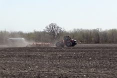
Last week, we cited reports of stressed-but-surviving corn and soybean crops in midwestern Ontario, which had received spotty showers early in the week. The crops were showing signs of drought-stress — such as wrapping and twisting of corn leaves — but were still roughly where they should be, considering the conditions.
A week later, with little rain, there are those who speculate some regions’ crops face ruin — but that hasn’t happened yet, says independent agronomist Peter Johnson, who agrees conditions are exceedingly dry, but insists there’s still time before significant yield loss occurs.
Read Also
ICE Weekly: More to canola price gains than Middle East war
The Middle East war is not the only thing affecting canola futures on the Intercontinental Exchange, said Tony Tryhuk, director of futures trading for RBC Dominion Securities in Winnipeg.
“Agriculture and Agri-Food Canada is showing — already — some areas with the most significant water deficit that they’ve ever had for the April 1 to June 27 time frame,” says Johnson, referring to a drought monitor map on the agency’s website.
“There are several other locations that are second most-significant in terms of water deficit, particularly in eastern Ontario, the Ottawa Valley and the Kingston area, and then a pocket around Peterborough-Lindsay that’s just harsh.”
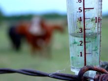
Precipitation maps from Chatham-based Weather INnovations also indicate some regions are in a severe moisture shortage. Essex, Kent, Elgin, most of Norfolk and down to Niagara, as well as most of eastern Ontario and the Near North, have received less than 120 mm from April 1 to June 15. Only to the lee of Lake Huron and Georgian Bay are there areas that have received more — and then only about 160 to 180 mm.
The exception appears to be the Sarnia-Forest-Watford region, where farmers have had to deal with recent and untimely downpours, which have forced many into replants on their soybeans.
“Right now in terms of corn yield loss, and I’m not saying the dryness isn’t hurting us, but if the corn leaves wrap in the heat of the day and then unwrap at night, the yield loss is not that significant,” says Johnson. “Give us two weeks more and put us a week before tassel, then things start to go south very quickly.
“We’re approaching a critical stage on corn, but let’s say we got two inches of rain tomorrow, the impact on the corn crop across the province wouldn’t be as great. The problem is that there’s no rain in the forecast.”
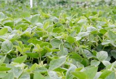
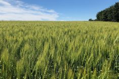
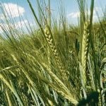
On the wheat side, Johnson believes it’s also suffering from the drought-like conditions, yet he maintains yields could provide a pleasant surprise to growers, although they won’t likely see record yields. Spring cereals are suffering from the excessive dryness which is shortening stems and impeding tillering.
With alfalfa, Johnson notes leaf hoppers are higher in numbers and growers need to control the pest. If plants appear drought-stressed, he adds, it’s more likely that they’ve been damaged by leaf hoppers and the dryness has become an added issue, causing stunting in the plants.
Click here for more details from AAFC.
— Ralph Pearce is a field editor for Country Guide at St. Marys, Ont. Follow him at @arpee_ag on Twitter.