Forecast issued November 12, covering Nov. 12 to 19, 2025
Highlights
- Developing conditions suggest above-average temperatures, limited precipitation and light winds across the Prairies.
- Alberta can expect above-average temperatures save for a cooler weekend. Western upslope regions could see some snow towards Friday.
- Saskatchewan and Manitoba should see a warming trend mid-week. Temperatures could push into the 10 to 15 C range on Friday.
Once again, the weather models had a good handle on the overall weather pattern. Small variations in the timing and track of individual systems led to some differences in local conditions, but the general trend unfolded as expected.
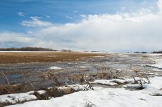
Winter made a brief attempt to establish itself late last week, bringing snowfall and colder air to many regions. However, warmer Pacific air quickly surged back across the Prairies and erased much of the early winter snow cover.
Read Also
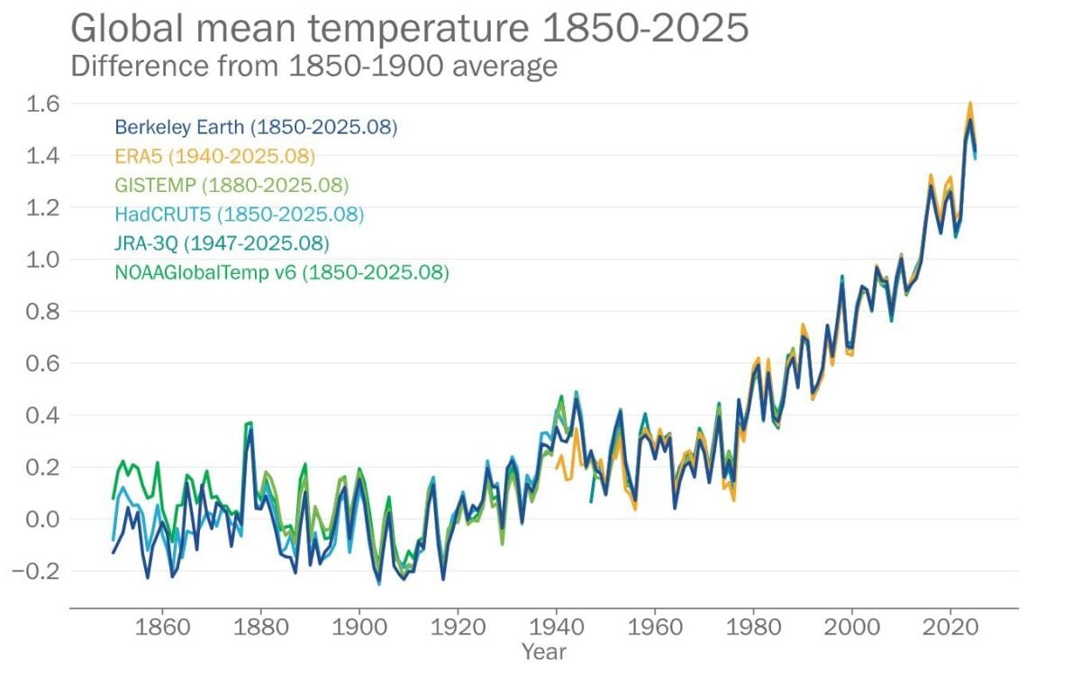
2025 set to be among hottest years on record: WMO
With only two months remaining in the year, 2025 is set to be among the top three hottest years on…
Looking ahead, it appears winter will remain mostly on the sidelines for now. A split flow is setting up across North America. This tends to keep strong cold air bottled up farther north while diverting major Pacific systems away from the central Prairies.
A persistent trough of low pressure remains anchored off the West Coast while another broad area of low pressure lingers over northern Quebec. The combination of these two features helps to establish weak ridging over the Prairie provinces. That pattern generally supports above-average temperatures, limited precipitation, and lighter winds across much of the region.
For the next week to ten days, temperatures are expected to remain warmer than normal across most agricultural areas. Expect only a few brief cool-downs as weak systems slide through. While scattered light precipitation is possible at times, no organized storms are on the horizon, and no significant accumulations of rain or snow are currently expected.
Alberta
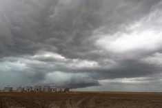
A ridge of high pressure will build across Alberta to start the forecast period while a developing low pressure system moves inland from the Pacific and tracks toward the Peace River region by Thursday.
Ahead of this low, mild Pacific air will push across the province. This will bring daytime highs in the 5 to 10°C range on Wednesday and Thursday. Some areas in southern Alberta could see temperatures climbing into the mid-teens.
The Peace River low is expected to produce increasing cloud cover and light snow across northern and western parts of the province Thursday into Friday. As the system strengthens, while moving eastward into northern Manitoba, 5 to 10 cm of snow may accumulate in western upslope regions.
Related: Prairies have variable soil moisture conditions
Behind this system, slightly cooler air will settle in for the weekend. Daytime highs should hover near 0°C across northern and central Alberta and around 5°C in southern regions. Skies will gradually clear as another ridge of high pressure builds in from the west late in the weekend.
By early next week, this ridge will amplify in response to a sharp trough re-forming off the West Coast. This will set the stage for another stretch of quiet, sunny, and unseasonably warm weather. Expect highs near 10°C in the south, with temperatures closer to 3°C over northern areas.
Saskatchewan and Manitoba
Across Saskatchewan and Manitoba, the period begins under a weak west-to-northwesterly flow aloft as a broad low slowly drifts eastward over northwestern Ontario.
Farther west, a developing Alberta low and an accompanying ridge of high pressure ahead of it will usher in a notable warming trend through midweek.
The low is projected to move from north-central Alberta on Thursday to northern Manitoba by Friday evening. With this track, most precipitation will remain north of major agricultural regions, leaving the central and southern Prairies mainly dry. Ahead of the system, mild air will surge across the region, pushing daytime highs into the 10 to 15°C range on Friday.
As the system departs eastward, cooler air will spill southward behind it. Over the weekend, a broad cyclonic flow will strengthen over eastern Canada, drawing cooler north to northeasterly winds across eastern Saskatchewan and Manitoba. Expect partly cloudy skies and daytime highs ranging from -2 to +2°C.
These cooler conditions should persist through much of the weekend, but early next week, forecast models suggest a weak but broad upper ridge may redevelop over the Prairies.
If that ridge takes shape as expected, it will bring a return to plenty of sunshine and gradually moderating temperatures, with highs climbing back into the 2 to 5°C range by midweek.
No significant storms or widespread precipitation events are indicated at this time, and the pattern seems to remain generally mild and stable into the second week of the forecast period.